Civil engineering
Key considerations for site levels
- Surface water drainage
- Flood volume comp
- Environmental contamination
- Cut and fill balance
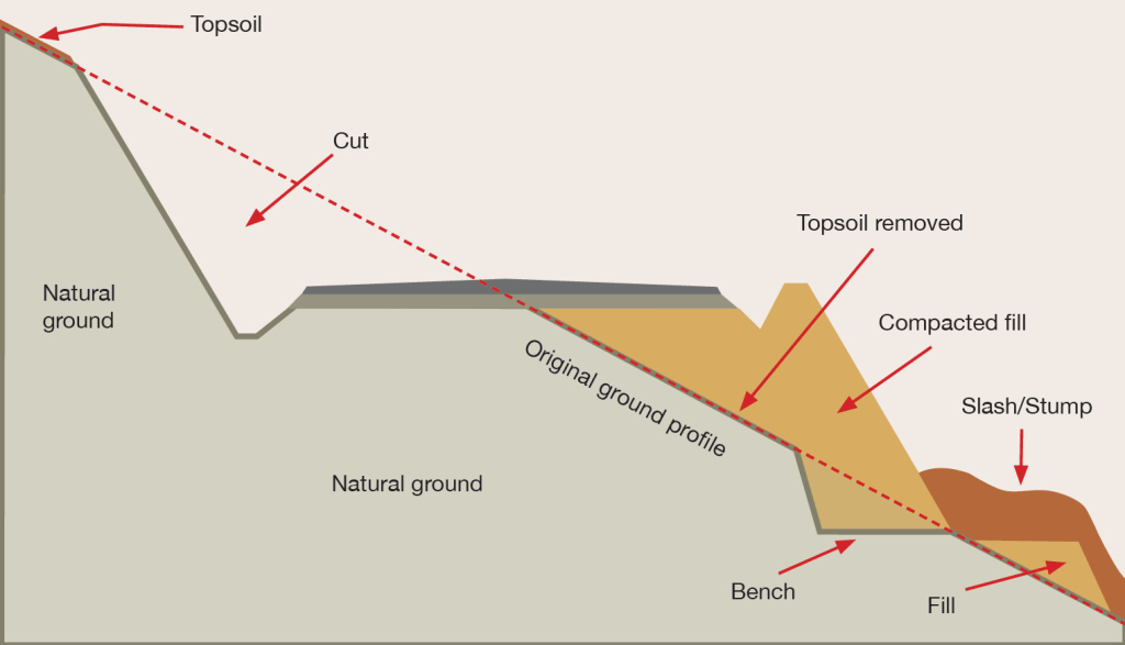
Cut and fill example
AutoDesk civil 3d is a software to use for planning height management on a site. During my time in practice it was often used to
We need to be aware of flood. risk, time based measurement. And the probability of the one in a hundred year storm happening at any time.
Earthworks
Excavations, Top soil is removed, recountouring bel
Positions of pipes always need to be included in planning processes
Bulking factor / Shrinkage factor ->
Compaction -> Proctor test
If a CBR of 5% or more is measured, standard build ups can be carried out.
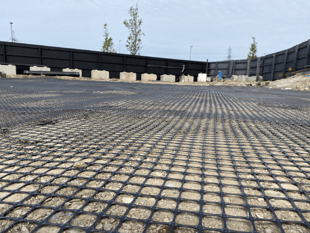
Geogrids can be very effective and will provide an additional level of support insted of bringing in capping on top of the subgrade.
Another way of aubgrade improvement can be using lime/cement treatment.
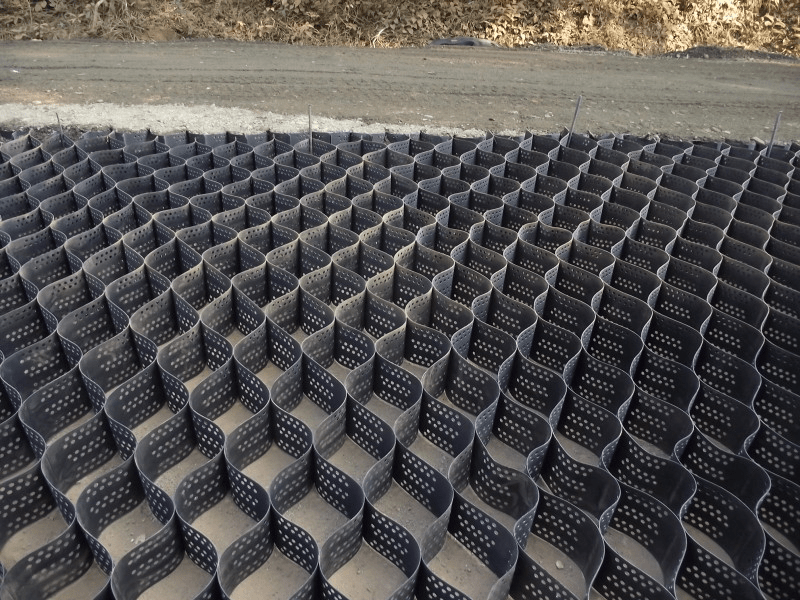
The amount of pressure on the ground can be reduced using cellular confinement systems
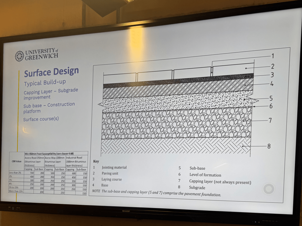
Standard build-up example
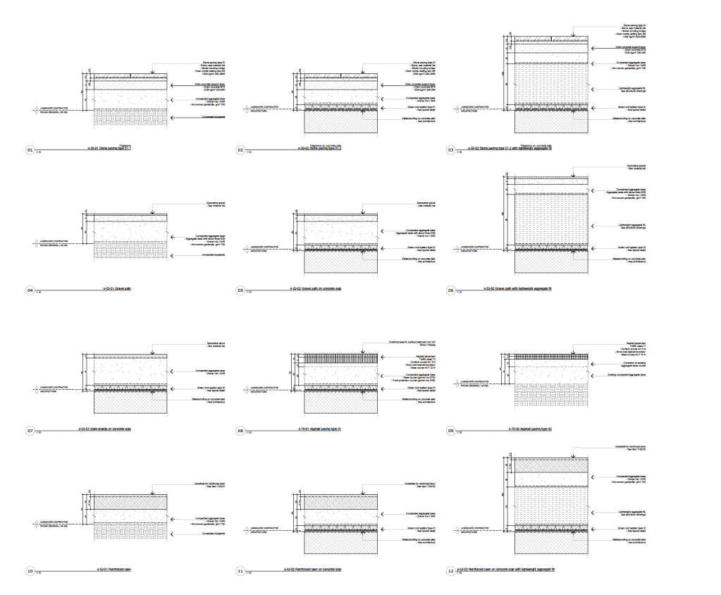
Range of standard details I planned for a project in Switzerland.
Flood zones 1-4
Be aware that soil can vary a lot and sites can have different soil types.
- All the different types should be tested
Planting areas and soil depths always have to be planned carefully and coordinated with the contractor.
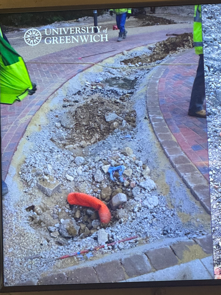
Example of a planned shrub area. Visible not enough depth for soil.
In cases like that it’s always important to think about the planting details and provide the right drawings as well as communicating with the contractors to make sure that it will be carried out correctly.
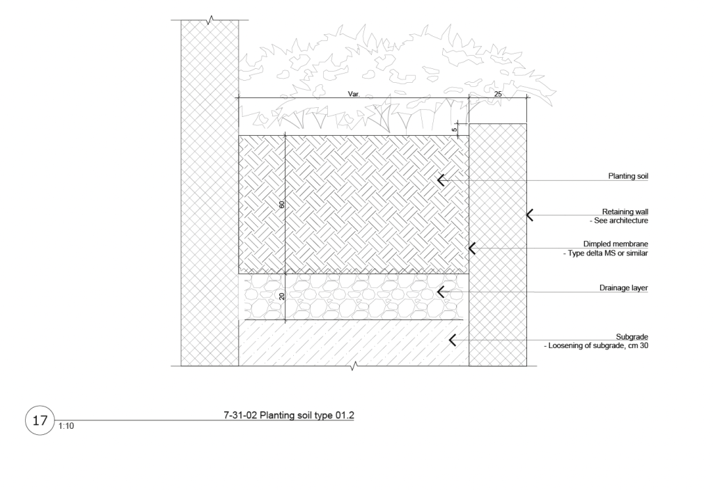
Example of a detailplan for similar situation (planting between two retaining walls)
Soil contamination
Sites always have to be investigated carefully on noticeable characteristics:
- Unpleasant smells
- Striking colors or tints
- Chemical waste or other pollutants
- Signs of heat
Soil contamination is a big issue that I haven’t come across in the extend as I worked in practice in Switzerland.
A marker layer can be laid over the contaminated soil and then be covered by 600mm of subsoil and 400mm of topsoil.
Another form of conamination:
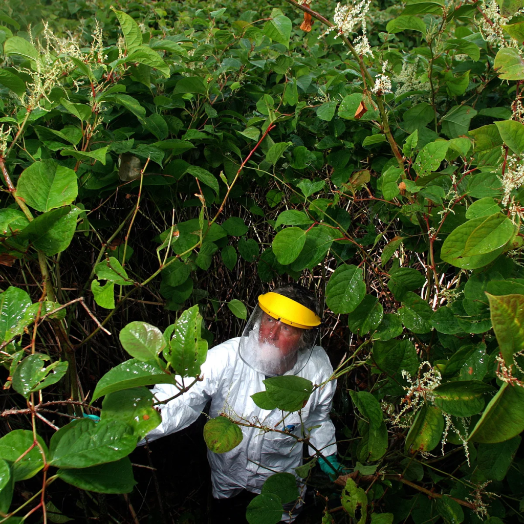
The japanese knutweed crowds out native plants, erodes riverbanks, and can cause structural damage to buildings by growing through foundations, walls, and paving.
How to determine the amount of soil for a tree
If we know the area occupied by the tree canopy (Crown projection), we multiply it with the leaf area index (gets us the leaf volume). We then have to include the evaporation rate (can be looked up from meteorological date) and the correction factor (calculated from research: 20%) index. That gives us the daily tree water use.
Daily water use x rainfall frequency : available water holding capacity of the soil = a realistic soil volume
Example:
Tree with a 3m radius -> around 28m2
28m2 x 5 (leaf area index) x 5mm (evaporation rate) x = 140 (daily ater use)
140 x 10 d (rainfall frequency) : 0.13 (available water holding capacity) = 10.8m3.

Leave a comment